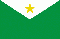
Normandia is a city located in the northeastern region of the Brazilian state of Roraima. Normandia covers 6,960 km2, and has an estimated population of 11,532 as of 2020 with a population density of 1.28 inhabitants per square kilometer. The municipality consists almost entirely of indigenous areas; 98.6% of the land area of the city is part of the Raposa Serra do Sol indigenous reserve. The remaining area consists of the city seat located close to the Ireng River which forms the Brazil-Guyana border.
Normandia is located in an ecotone, a transition area between two biomes. The municipality sits between the great tropical Amazon rainforest region and the cerrado, an open Savanna-type grassland. The transition area is known locally as the lavrado. The lavrado of Roraima, and of Normandia, is relatively dry compared to the nearby Amazonian rainforest areas; it receives between 1100 mm and 1400 mm of precipitation per year.


